Once Upon a Time in The West: Exploring the Wild Atlantic Way
While my wife and I have travelled throughout the world, there are large parts of Ireland we haven’t visited. People often ask us about various famous locations around the country and we have to respond that we’ve never been. When Covid struck, and the world turned upside down, we aimed to fix that and began exploring our own little nation that much more. Last year we visited the southeast, and a few weeks ago, we decided to spend a little time exploring part of the west coast, and drove some of the famous “Wild Atlantic Way”.
It might seem odd to people from outside of Ireland, but growing up on the east coast of the country in the 80s, the west always seemed like another world away. It was the side of the country where movies came from and the land fell away into the Atlantic. It was the world of the famine and bad Irish accents from Tom Cruise and Nicole Kidman. Getting there in the 80s before the motorways that now crisscross the country took far longer than it does now. When you’re in your 20s and don’t have a car, it seemed almost easier to explore London and Paris than it was to get to the west of Ireland. Today, that’s a very different story.
The west of Ireland is now a tourist goldmine, and this has opened up some of the most beautiful parts of the country and made them much more accessible. Places I had only heard of in geography and history books, are now only a few hours drive away, and the improved roads make them easy to navigate. In fact, it was once such innovation by the tourism boffins on the west of the country that has opened up much of this and made it super easy to get around. That is the creation of “The Wild Atlantic Way”.
The Wild Atlantic Way is a route around the west coast of Ireland. It’s 2600km of coastal roads, that run along the Atlantic seaboard, from Derry in the north of Ireland to Cork in the south. While these roads were already there, someone came up with the idea of combining them into a single route and marketing the hell out of it. This might seem like a simple thing or even a cynical marketing ploy, but it was actually kind of genius. In doing so, they signposted the entire network of roads, encoding them all with the wavy symbol of the route, making it super easy to get around, and connected the many interesting and wonderful sights along the way. Even if you don’t have google maps, you could find your way along the wild Atlantic way. Since its inception places along the roadway have capitalised on this and it’s become a sort of beacon for various hostels, hotels, restaurants and pubs. But that’s not why we went. We went for the scenery. And oh my god, what incredible scenery.
We only took in a small part of the route, from Galway along the coastline of the Burren in Co. Clare to the Cliffs of Moher. The latter is one of the most famous sites on the Atlantic seaboard. But more on that in a minute.
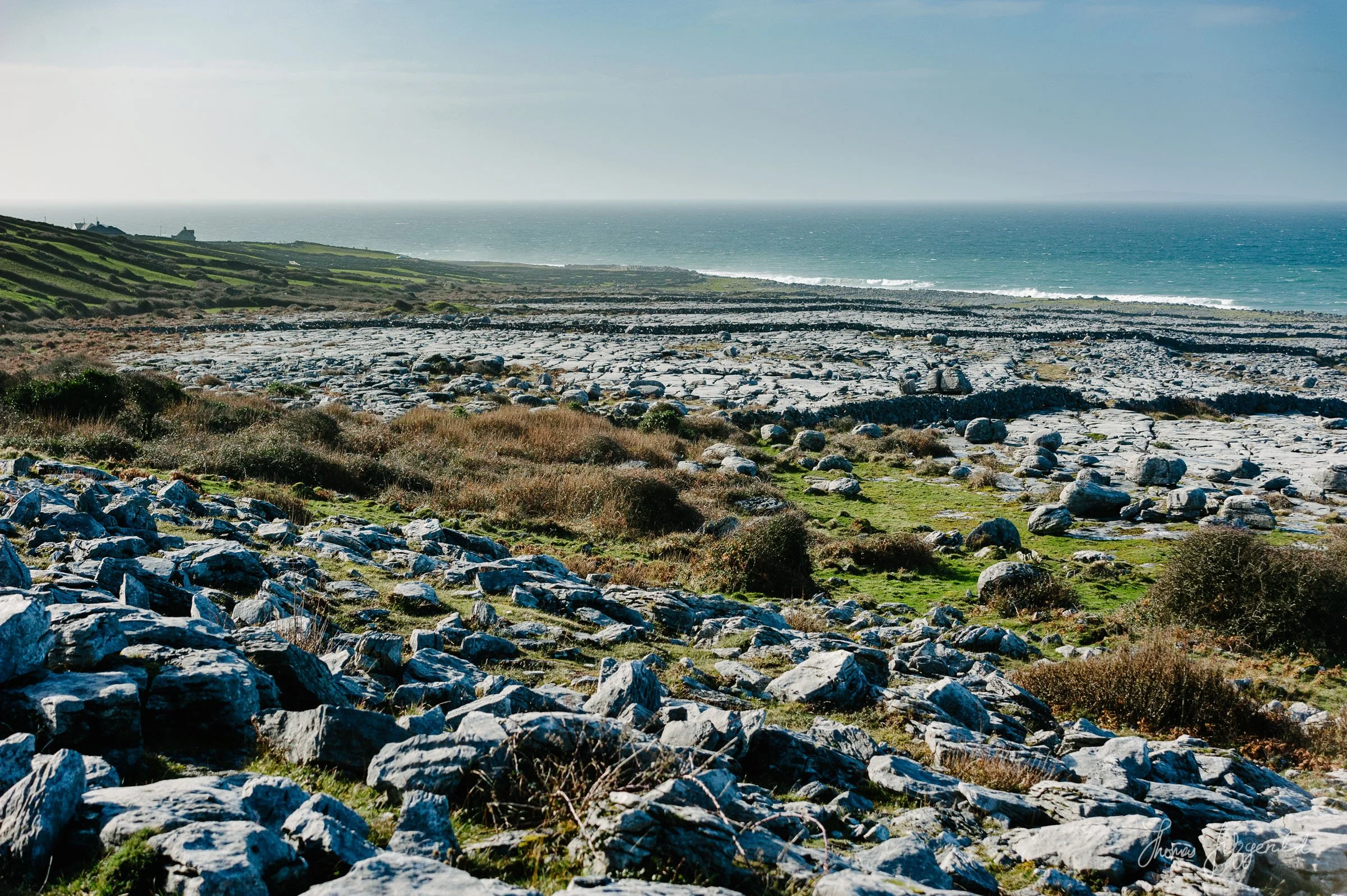
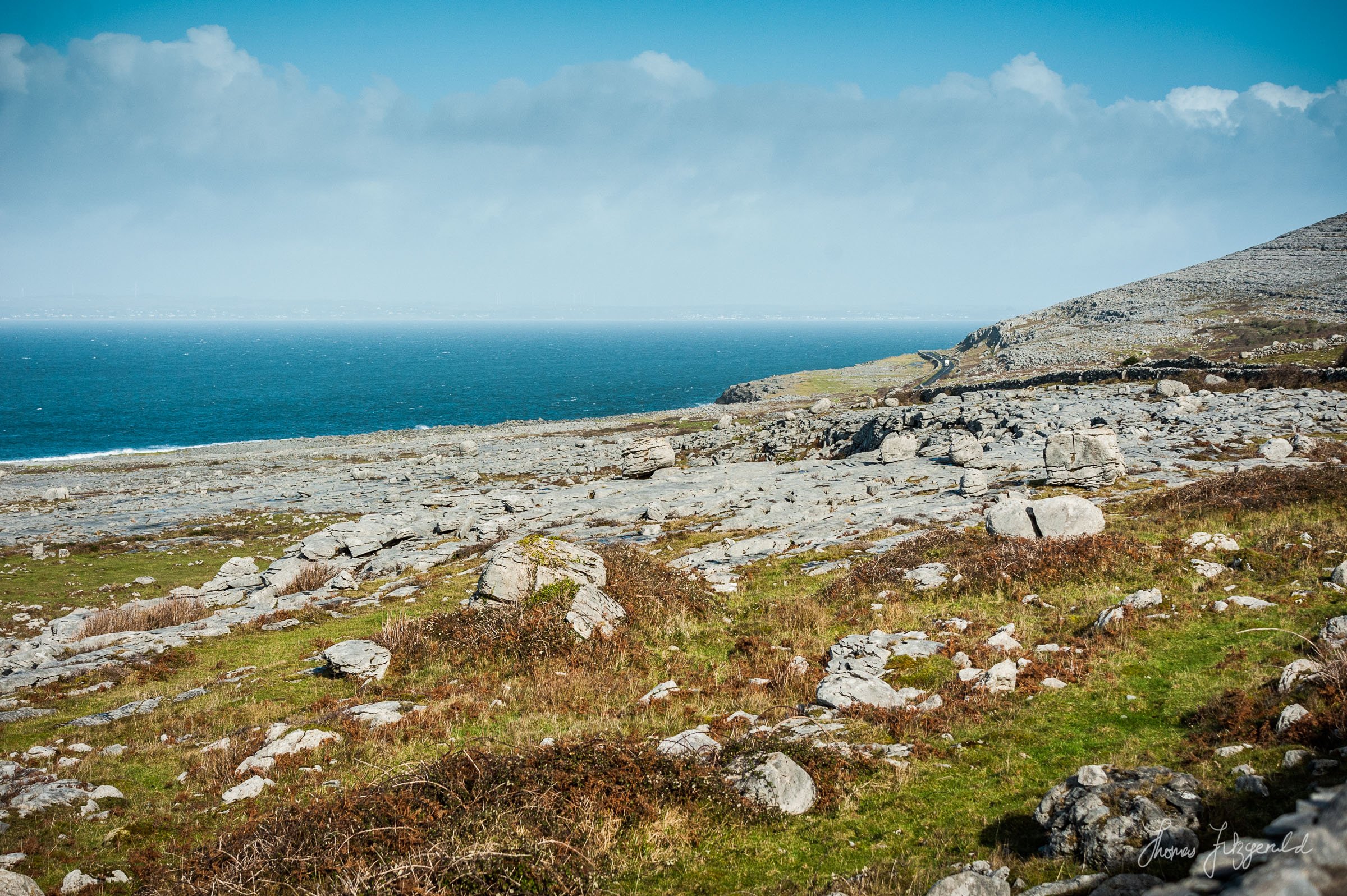
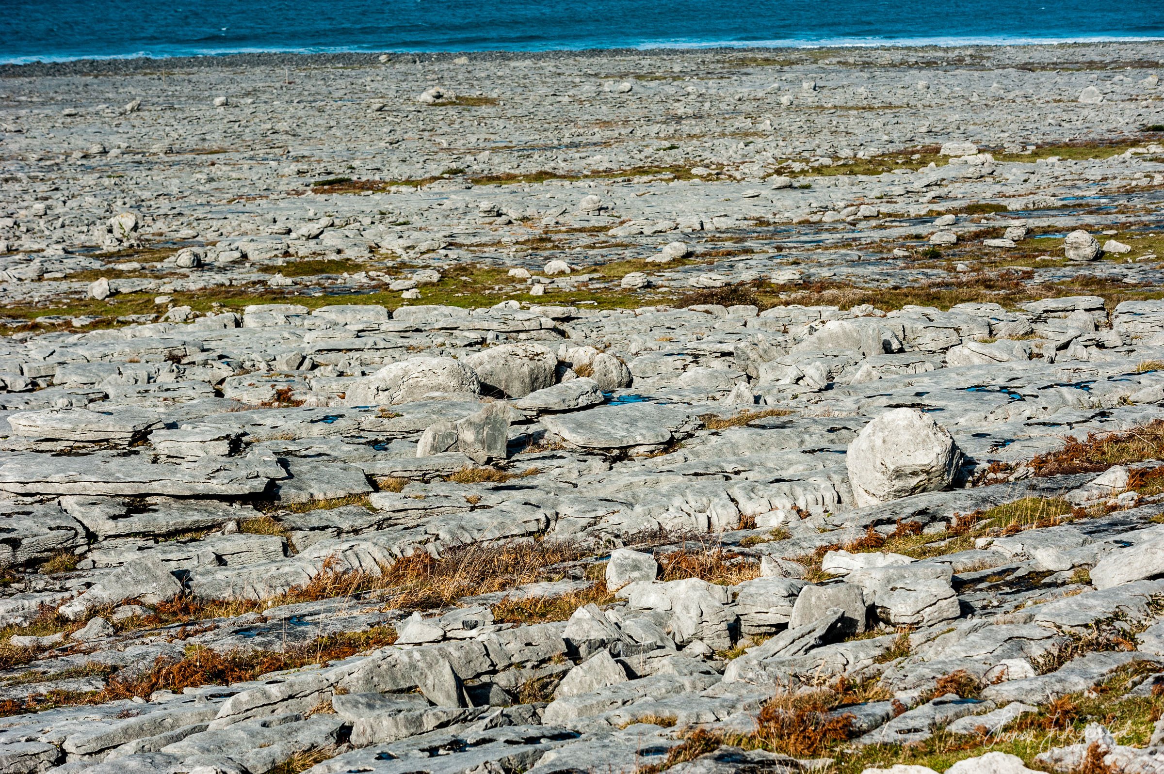
The first part of our journey took us through the Burren in Co. Clare. The Burren is somewhere you always read about in school growing up in Ireland. But the idea I had of it in my mind is nothing like what the real thing turned out to be. I always had a picture of it in my head as this big flat field of rock, but it’s actually a large part of the county, and it consists of hills and mountains and rocky cliffs.
And it is absolutely stunning.
Geographically speaking, the Burren is a limestone landscape leftover from the last ice age. The scenery consists of limestone terraces which are littered with numerous rocks and large boulders. These boulders, called “erratics” were deposited when the glaciers that covered the country retreated in the last ice age. Erosion and other forces have eaten away at the landscape over the thousands of years since and created the unique vista that you see today. As well as the rugged and beautiful landscape, it’s also home to a large amount of nature and is home to a national park as well as being a UNESCO registered Geopark.
As we drove around the coastline we marvelled at the stark and rugged beauty of the coast. The limestone hills roll down to the sea, and the land is covered with stones and rocks. Signs along the way ask people not to take the rocks, as they are part of the heritage of the region. We stopped at a few places along the road, where there was room to pull in. Even though it was the offseason, there were still large tour busses coming in the opposite direction every now and then.


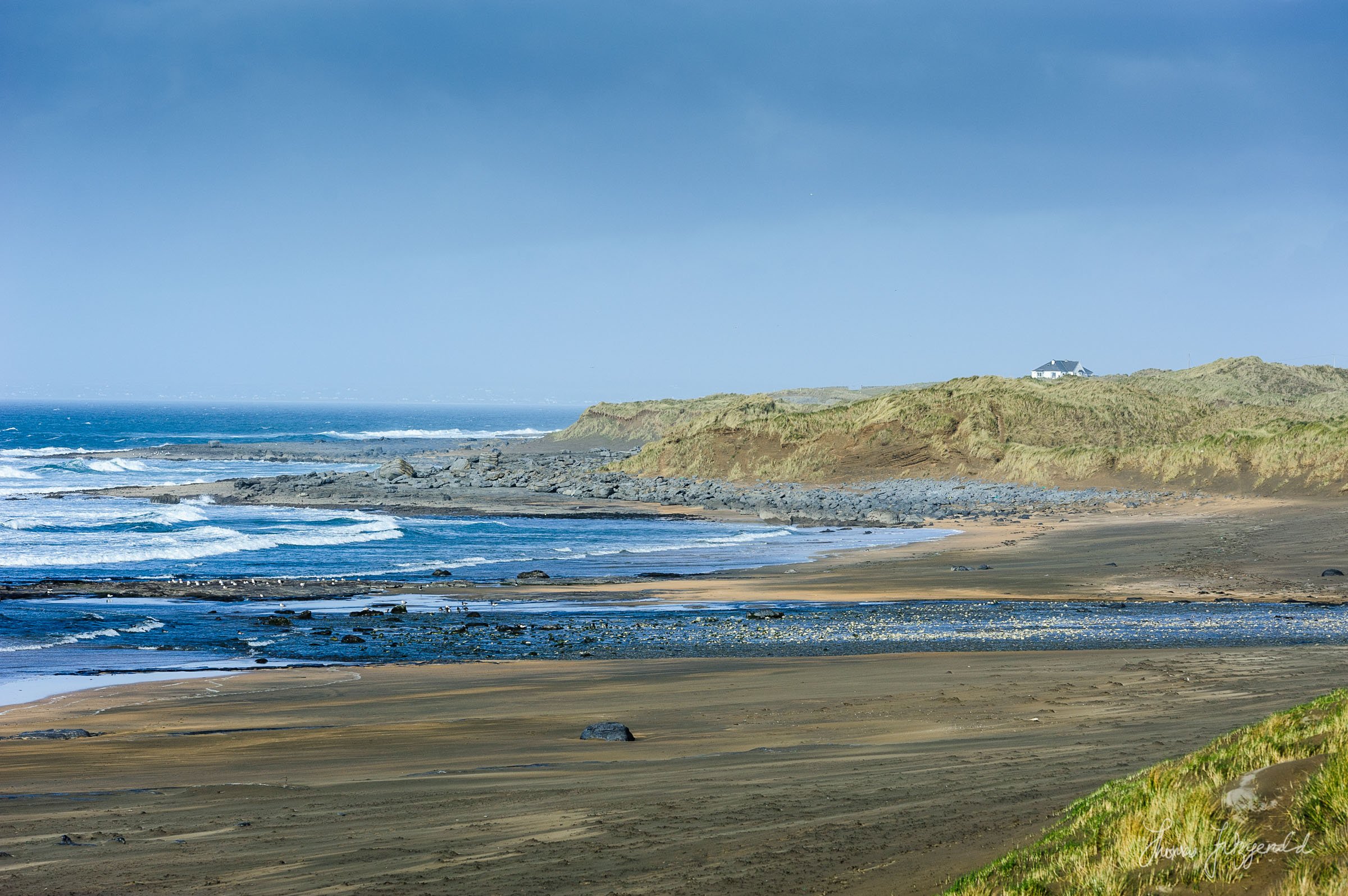
While driving along we saw a sign for Fanore Beach and decided to pull in. We didn’t know it at the time, but apparently, this location is pretty famous. Aside from the beautiful sandy beach, which was being battered by a constant offshore breeze, it is also a site of an ancient settlement, and one of the oldest in Ireland.
The sound of the waves on the beach was something else. As the wind caused a layer of sand to blow across the beach like a constantly undulating carpet, the roar of the waves echoed around the bay. It was both deafening and soothing at the same time. As I stood trying to capture the stark beauty with my camera, I realised that there was almost no one else there. This sense of isolation only added to the stark beauty. There were a couple of dog walkers on the sand trying to coax their dog away from what appeared to be a large dead fish washed up on the beach, and as we were leaving a couple decided to brave the waters in wetsuits for some sea swimming. The breeze was freezing enough, so I can’t imagine attempting to swim in the Atlantic in the middle of February, wetsuits or not.


Our next stop was the little town of Doolin. Doolin is the location of the ferry to the Aran Islands, but that wasn’t on our agenda. We stopped for a lovely late lunch in a place called McGanns Pub, a charming Doolin institution apparently, before heading on our way to the Cliffs of Moher.
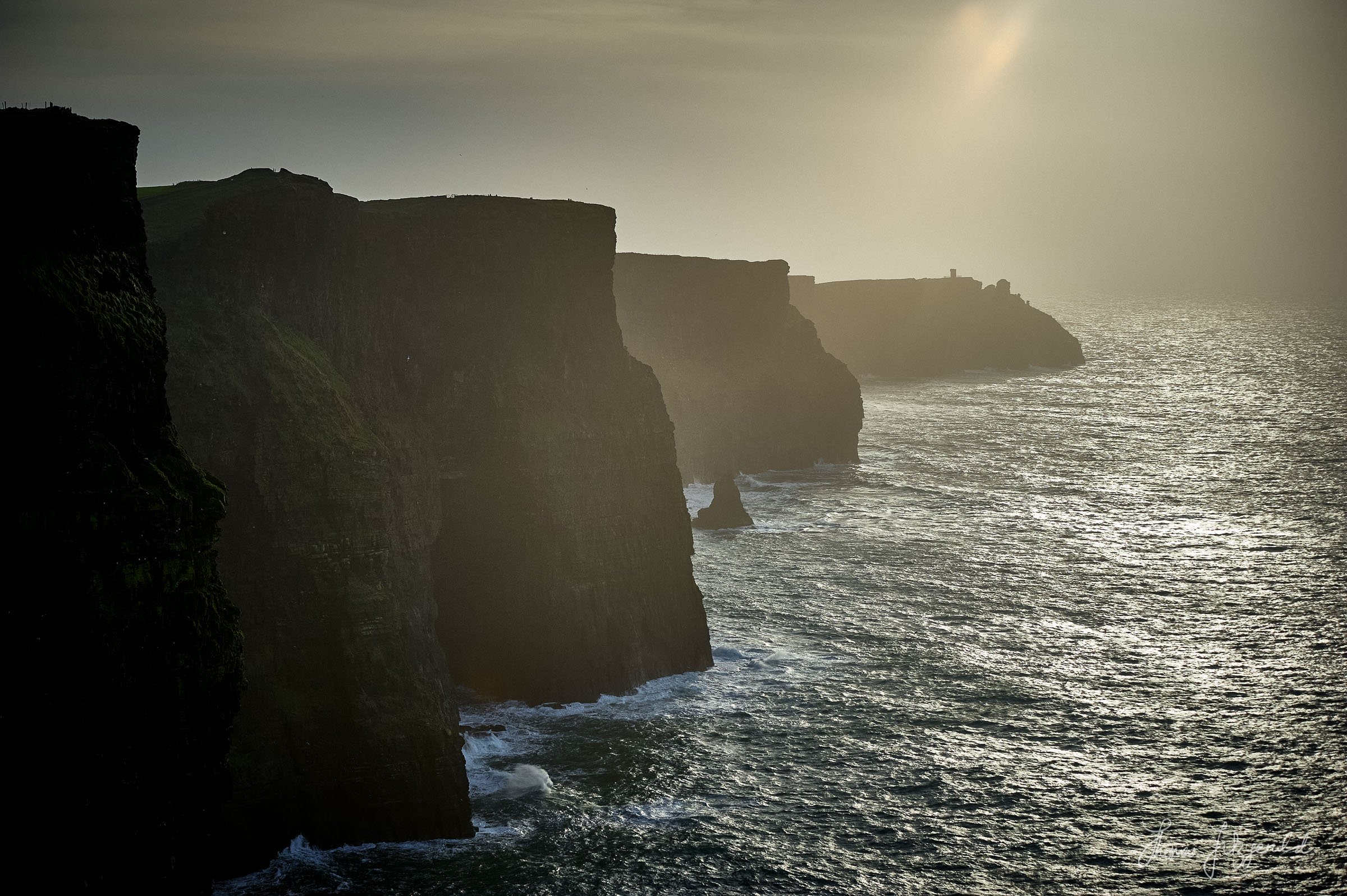
Finally, we got to our destination: The Cliffs of Moher.
The Cliffs of Moher is probably one of the most famous sites in Ireland. The cliff faces have been featured in numerous movies, not to mention plastered all over Instagram and youtube from various travel influencers. They are quite a stunning sight to behold. Not great for one's vertigo mind you. The wind blowing onshore didn’t help matters. We had hoped to be there for the sunset, or at least near sunset to get some good pictures, but the lighting conditions weren’t great. There was a strong sea mist and it was cloudy overhead. It had supposed to be stormy that day, but luckily we escaped that. Apparently, it is quite common for the cliffs to be completely shrouded in fog, and you can’t see anything.
We stayed for an hour or more, and I took several shots, but in the end, I wasn’t completely satisfied. But it was an incredible sight, and it only made me want to come back again, in slightly warmer and less windy conditions.


On the drive back to our hotel in Galway, I reflected on the stunning scenery that we had seen. We took a different route back, passing through the towns of Lahinch and Ennis, before rejoining the motorway back to Galway city. I realise how lucky we are to live in such a beautiful country, and I was kind of mad at myself for leaving it so long to explore this part of the island. I had always put it off as being something that had become “too touristy” but I realise now that it is an important part of the nation’s geological and cultural heritage, and while the pandemic was a total nightmare in so many ways, at least it gave us the reason to explore our home a little more.
Looking towards Lahinch, Co. Clare
Technical Details - Camera: Nikon D700, Lens: Sigma 70-200 f/2.8. Processing in Lightroom, Capture One and Photoshop
All images are Copyright ©2022 Thomas Fitzgerald Photography. To License visit my Photography Archive. For Prints, Please Contact.